Featured Projects
Take a look at some of the projects we’ve completed for our clients.
Biomass Assessment Using Mobile Laser
In complex forest, we specialize in advanced forest point cloud analysis to develop individual tree extraction and create detailed Quantitative Structure Models (QSMs) using Arbor. By combining cutting-edge algorithms, biological modeling, and precise measurements. We developed accurate estimates of tree structure and wood volume, enabling deeper insights into forest ecosystems.

Wood semantic segmentation
Wood and foliage semantic segmentation in complex forest contexts

Tree instance segmentation
Individual tree segmentation in complex forest context

Individual tree isolation
Extraction of each individual tree.

Quatitative Structure Model
3D reconstruction of each individual tree (also known as a Quantitative Structure Model) to estimate volume & biomass.

Modelling
Total biomass estimation and allometric modeling.
Plantation Growth Tracking Using Drones
In Canada and New Zealand we worked on individual tree segmentation in plantations using drone-based laser scanning. This innovative approach allows for precise measurements of tree height and crown diameter, providing valuable data for monitoring growth and improving plantation management and tree genetic. By leveraging drone LiDAR technology, we can track tree development over time, enabling more efficient and accurate forest management practices. We developed custom applications that integrate each client’s plantation database, allowing us to match LiDAR-measured trees with those recorded in their records.

Custom Application
Custom application designed to meet the client’s specific needs

Tree Detection
Individual tree detection and height measurement of each tree.

Tree Segmentation
Measurement of the crown size of each tree.

Shadow map
Ray-shaded CHM for measuring tree illumination and shadows.

Statistics
Statistics by clone and block generated from plantation database
Forest Plot Scan Alignment and Registration
We designed a robust and easy-to-use package for aligning and registering airborne, drone, terrestrial, and mobile laser scans of forest plots. It has been benchmarked against published methods and tested on numerous datasets, showing superior performance in terms of speed, accuracy, or ease of use, thanks to its parameter-free design. See more details here.

Canopy alignment
Fine alignment of MLS and ALS point clouds

Tree alignment
Extra fine alignment of TLS and MLS point clouds

Robust
Robust to extreme original misalignments

Performant
More efficient, accurate and simple than state-of-the-art alternatives. See details.
Boat Measurement
We developed custom software to measure boats passing in front of a static LiDAR and interfaced the software with the lidar for real time processing. While our core expertise lies in forestry-related point cloud processing, we also apply our skills to a wide range of point cloud projects.

Custom software
Software designed to analyze boats passing beneath a structure
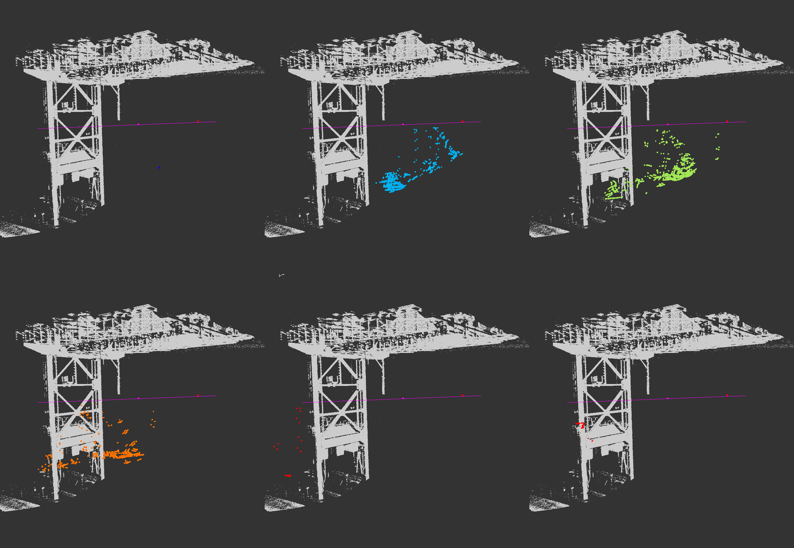
Robust Measurements
A robust measurement method developed to handle sparse sampling
Road Segmentation
In Quebec and Alberta, Canada we segmented the road network using airborne laser point cloud, using machine learning and a homemade network vectorization to produce vectorial, accurate and topologically valid maps of the forest roads which could be used for ongoing monitoring and management of forestry operations.

Road segmentation
Shaded DTM with unsupervised road mapping.

Road segmentation
Close-up view.

Road vectorization
The vectorization algorithm drives the map produced by machine learning and generates a vector-based geospatial map.
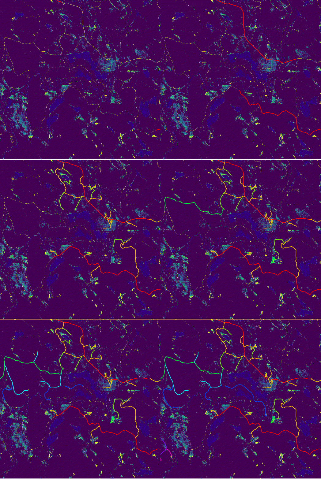
Road vectorization
Animated image of the vectorization process
Bridge Segmentation Using Airborne Lidar
We worked in Québec, Canada, on bridge segmentation using airborne laser scanning (ALS) point cloud data, specifically within forestry contexts. This involves developing methods to accurately identify and isolate bridges in potentially complex forested environments, where distinguishing between natural and man-made structures can be challenging. The ability to efficiently segment bridges from ALS data is crucial for cleaning the point cloud from human made structure in order to retain and process natural land only. By integrating bridge segmentation with forest structure analysis, we can enhance land use modeling.

Bridge segmentation
Bridge semantic segmentation in a forest context.

Bridge segmentation
Small bridge semantic segmentation in a forest context.

Bridge segmentation
Bridge instance segmentation in a forest context.